Where did you say you were calling from?
- The round earth on a flat map = “a projection”
- imagine putting a strong light bulb in or near a transparent globe and then holding a piece of paper around the globe or in front of it.
How many ways could you do it? - answer? Flat, wrapped cylinder, wrapped cone, cut up into wedges.
- Let’s try some….
In QGIS open the “project the world” map in the introPro project (exercises-today/jan22 lecture3….make sure you make your own local copy)
- Cylindrical (e.g. “Mercator”) – EPSG 54034
- Azimuthal (for poles) – EPSG 54032
- Conic (one latitude is tangent, called the standard parallel) – EPSG 54027
- Polyconic (multiple latitudes tangent) – EPSG 54021
- etc (too many to mention them all )
Here’s a comparison of some, with some projection views.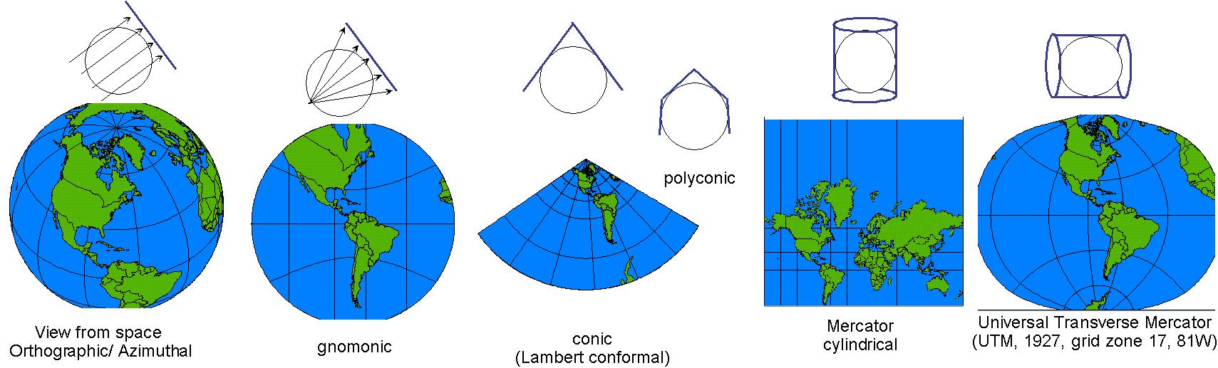
Edited by NDB Jan 22, 2025