Projections create distortion
QGIS Documentation on projections says:
It is important to make an appropriate choice of CRS for your QGIS projects. Choosing an inappropriate CRS can cause your maps to look distorted, and poorly reflect the real-world relative sizes and positions of features. Usually, while working in smaller geographic areas, there will be a number of standard CRSs used within a particular country or administrative area. It’s important to research which CRSs are appropriate or standard choices for the area you are mapping, and ensure that your QGIS project follows these standards.
A further, excellent article on coordinate reference systems (CRS) and projections cna be found here.
Find a good overview of these distortions at this web site https://www.axismaps.com/guide/general/map-projections/
The map has different names, depending on what you hold constant:
- equal area – homolographic — if you put a dime on a map, it’ll always cover the same area, but shapes and angles are distorted
- shape – conformal — at a point, relative local angles are preserved, meridians intersect parallels at right angles, areas enlarged or reduced
- scale – equidistant — equidistant between two points and rest of map only, or along meridians
- directional – azimuthal — all rhumblines (lines of constant direction) are straight
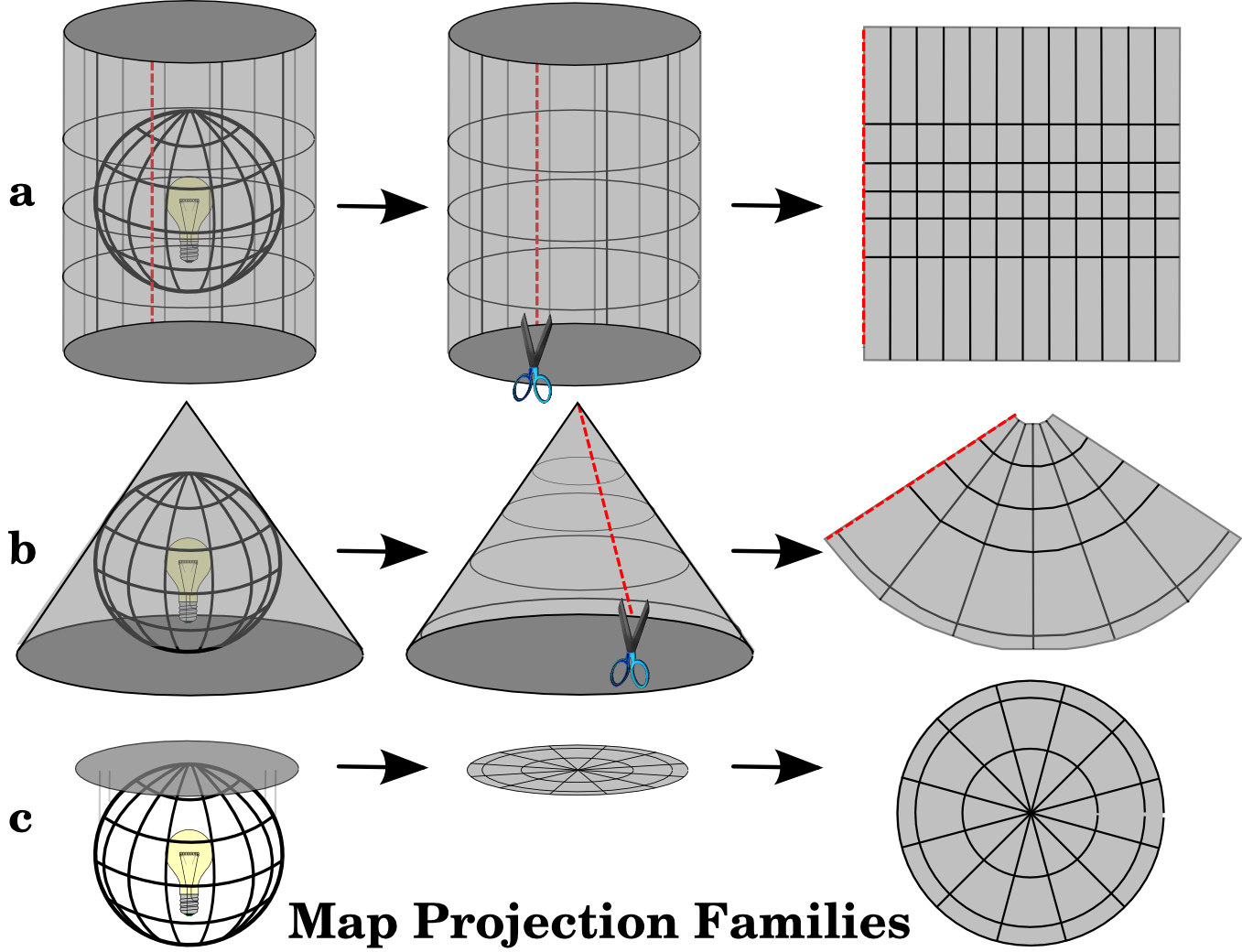
a) cylindrical
b) conical
c) planar
Open the Virginia Counties map from your introPro download project and change the coordinate system of the map to
- Projected/State Plane/VA state plane south zone (polyconic)
- Projected/UTM/NAD 1983/grid zone 17N and then try zone 5N (transverse Mercator)
- Projected/world/Mollweide (equal area?)
- Geographic/North America/NAD 1983 (simply longitude as x and latitude as y, or GCS- “geographic coordinate system”)
Compare size and shape. (Could you make a layout with 4 different maps using different projections? Have you learned layouts yet?)
The maker of the cartoon XKCD claims to have the “best” map considering all four of these potential distortions. The “Waterman” projection.
Edited by NDB Jan22, 2025